Projects
A selection of my geospatial projects. Click any card to see the full write-up.
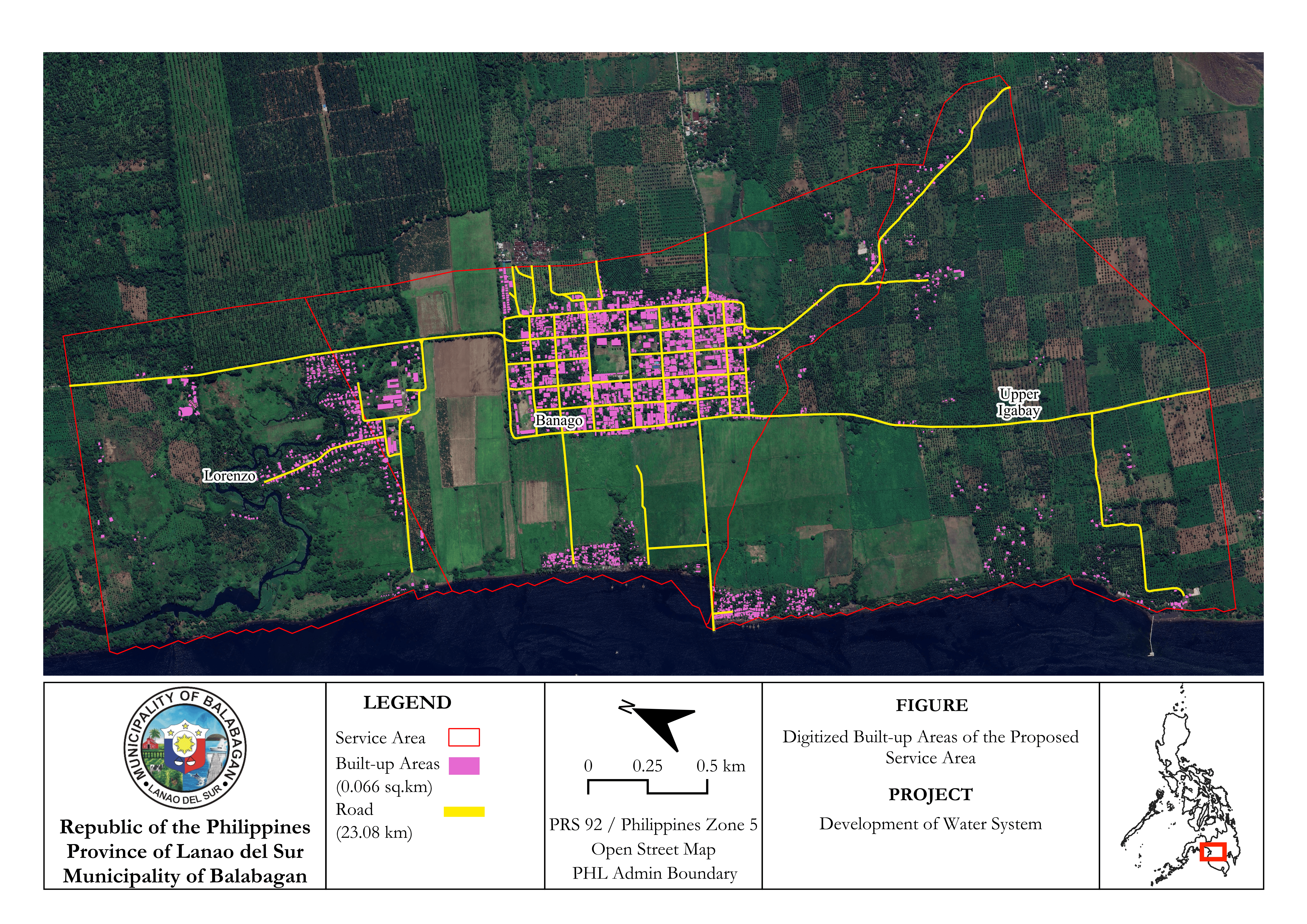
Water System Planning Support Through GIS Mapping, Watershed Analysis, and Hazard Assessment
This project provided GIS mapping, watershed analysis, and spatial decision support for a Level III water system feasibility assessment in Balabagan, Lanao del Sur, a coastal municipality in the Bangsamoro Autonomous Region in Muslim Mindanao (BARMM). The engagement combined desktop GIS analysis with direct field survey participation, producing 14 report-ready map layouts and a watershed catchment analysis alongside a verified spatial dataset of intake sources and survey points.
QGIS UP NOAH Field Survey
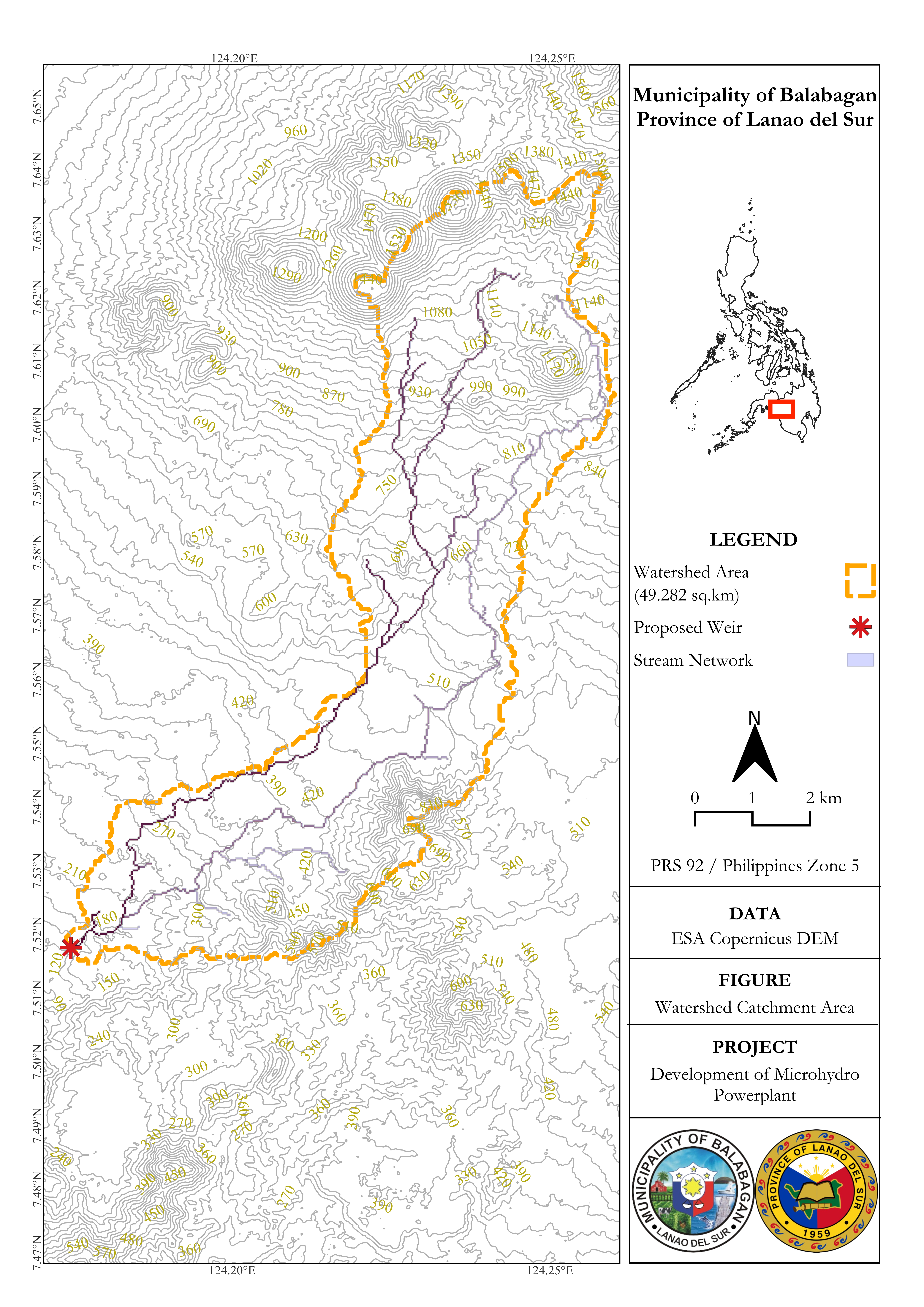
Watershed Catchment Area Mapping for Microhydro Powerplant Development
This project involved delineating and mapping the watershed catchment area of a proposed weir site along the Budas River in Balabagan, Lanao del Sur, to support the feasibility assessment of a microhydro powerplant. A single pour point was placed at the proposed weir location to establish the contributing drainage area, which would inform hydrological design parameters for the powerplant.
QGIS Google Earth Engine Copernicus DEM GLO-30
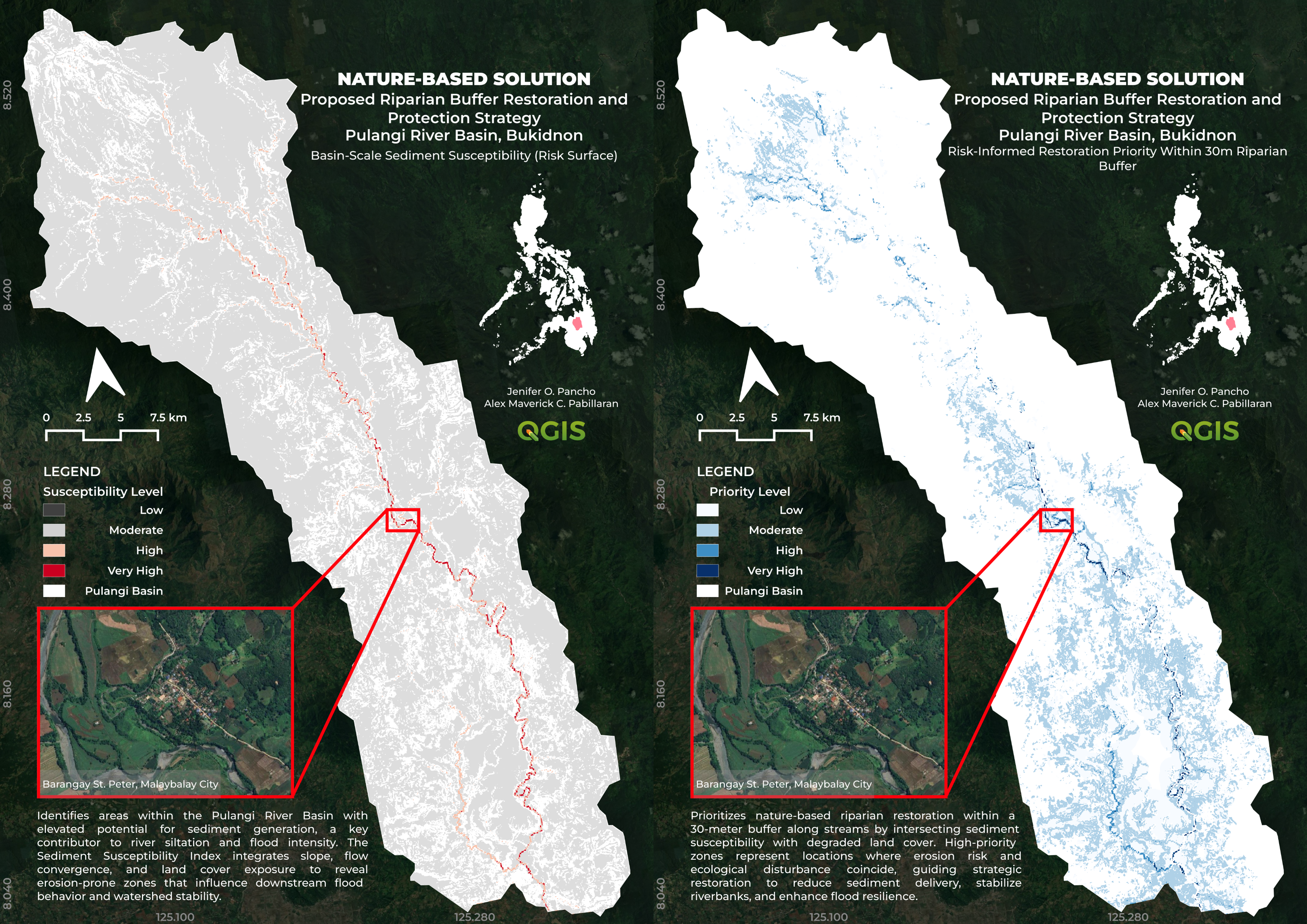
This project proposes a nature-based riparian buffer restoration and protection strategy for the Pulangui River Basin in Bukidnon, Philippines, using GIS-based watershed analysis to identify sediment-prone and degraded riparian zones requiring ecological restoration. The workflow integrates terrain analysis, hydrologic modeling, land cover exposure, and riparian buffer assessment to support flood resilience and sustainable watershed management through spatially explicit planning.
The project was developed as an entry to the Geographic Innovations for Development Solutions, Inc. (GRIDS) Mapping Contest with the theme: Enhancing flood management and resilience through nature-based solutions, and was awarded a Consolation Prize.
QGIS Google Earth Engine ESRI Copernicus DEM GLO-30
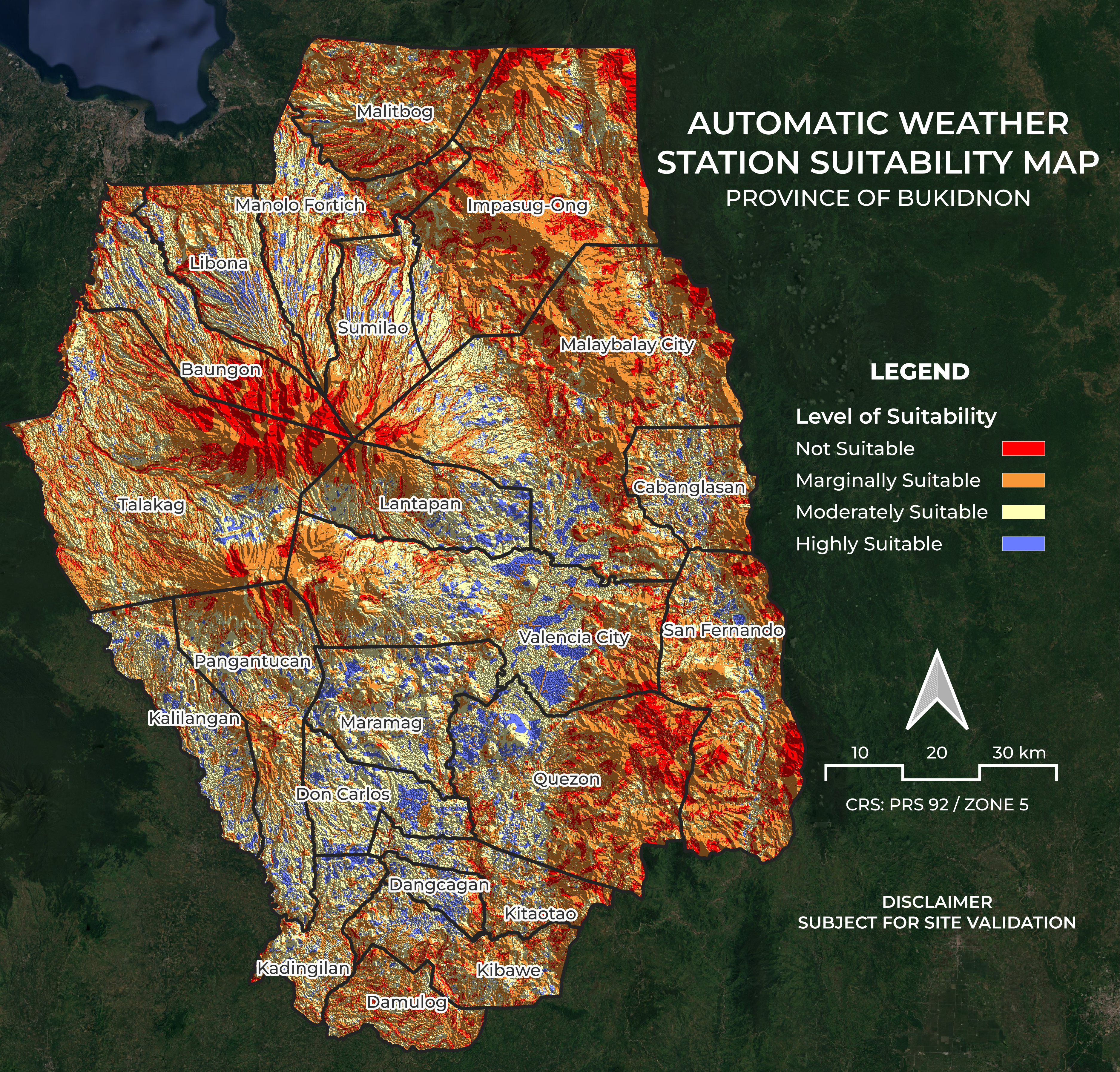
Automatic Weather Station Suitability Map
A GIS-based site suitability analysis identifying the most suitable locations for establishing Automatic Weather Stations (AWS) across the Province of Bukidnon, Philippines. Using the Analytic Hierarchy Process (AHP) as the multi-criteria decision framework, five spatial criteria were weighted and combined to produce a final suitability map classified into four levels — from Not Suitable to Highly Suitable — covering all municipalities of Bukidnon. The output is intended to support data-driven decision-making for weather monitoring infrastructure placement.
QGIS Google Earth Engine ESRI OpenStreetMap
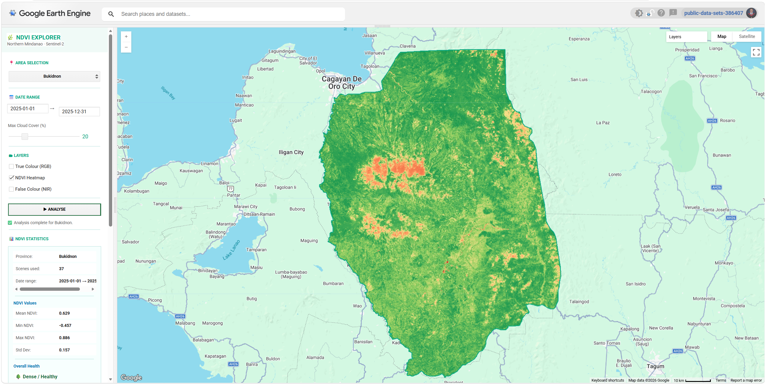
Regional Vegetation Health Monitoring System
An interactive web application built on Google Earth Engine that calculates and visualizes the Normalized Difference Vegetation Index (NDVI) for all provinces of the Northern Mindanao Region (Region X), Philippines. Designed as a passion project and presented at an exhibit, the app makes satellite remote sensing engaging and understandable for young audiences — turning complex geospatial science into a hands-on, visual experience.
Google Earth Engine JavaScript Sentinel-2 Harmonized
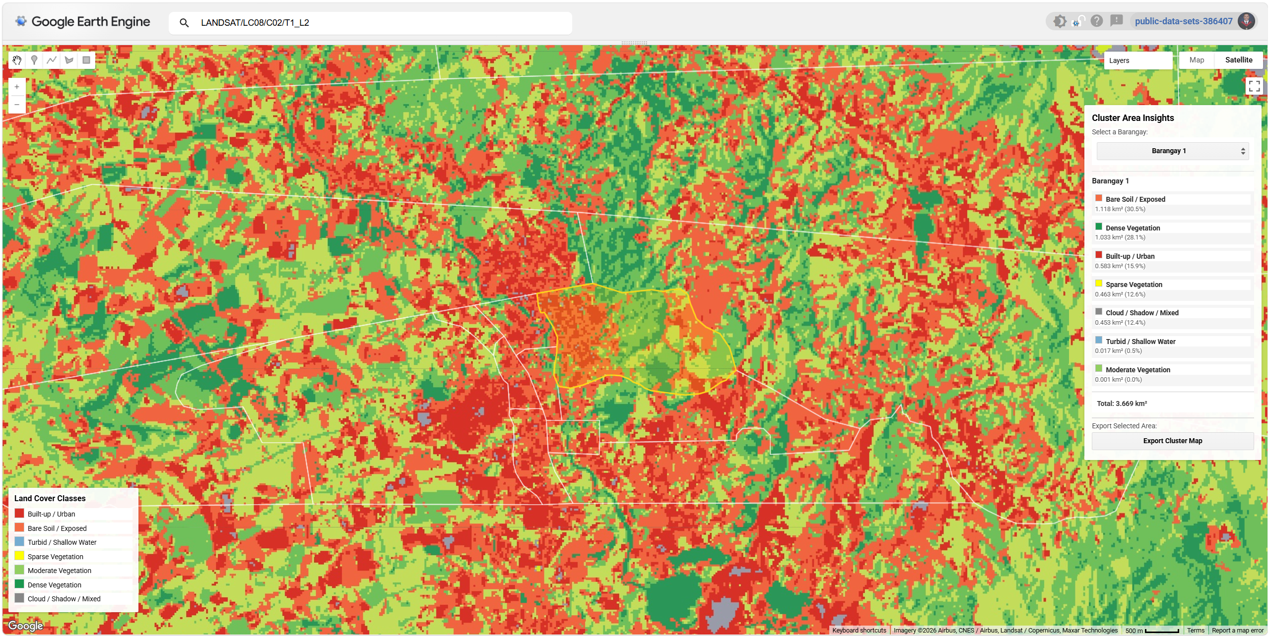
Unsupervised Land Cover Classification App
A machine learning project applying unsupervised K-Means clustering to Landsat 8 satellite imagery to classify land cover across Malaybalay City, Bukidnon, Philippines — down to the barangay level. Built as a personal initiative to explore machine learning in the context of remote sensing, the app generates a 7-class land cover map and provides an interactive barangay-level insight panel with per-class area statistics and export capability.
Google Earth Engine JavaScript Landsat 8